In the landscape of climate risks and extreme weather events, hurricanes remain one of the most destructive forces affecting coastal communities in the United States. Understanding and assessing hurricane risk is vital for insurers, property owners, and communities. A data-driven approach to risk assessment empowers insurers and other stakeholders to make more informed and detailed decisions in improving risk management strategies.
Assessing Hurricane Risk with HazardHub's Model
HazardHub provides over 1,000 data points and dozens of risk scores for various climate risks and perils, including tropical storms, hurricanes, flooding, and storm surge This HazardHub Hurricane Risk Model considers factors like the likelihood of Category 1 or major hurricanes, the proximity and distance of a property to the coast, and the frequency of tropical and subtropical weather events.
This HazardHub Hurricane Risk Model identifies the top ten states facing the greatest hurricane risk, those with the highest percent of properties rated as a “D” (high risk) or “F” (very high risk), as:
- Florida
- Louisiana
- South Carolina
- Texas
- Mississippi
- North Carolina
- Delaware
- Georgia
- Alabama
- Virginia
These states, primarily located along the Gulf Coast and the southeastern seaboard, are highly exposed to hurricanes and their associated impacts, such as storm surges and flooding.
Understanding Storm Surge Risk with HazardHub SurgeMax Scores
While hurricane force winds cause extensive damage, storm surges pose one of the most significant threats to life and property. HazardHub's SurgeMax Score is a specialized metric developed to measure the risk of storm surge flooding for any location. It considers various factors including historical NOAA storm surge data, local topography, and distance from the coast to estimate potential storm surge impacts. This score helps insurers and property owners assess storm surge risks, especially in coastal regions.
According to HazardHub's SurgeMax Storm Surge Flooding Model, the states with the highest percentage of housing units at risk of storm surge flooding (rated 'F') are:
-
Louisiana: 52%
-
Florida: 34%
-
South Carolina: 21%
-
Delaware: 20%
-
Virginia: 13%
-
Mississippi: 9%
-
North Carolina: 7%
-
Texas: 5%
-
Georgia: 4%
-
Alabama: 3%
These numbers highlight the vulnerability of properties in coastal regions, emphasizing the importance of understanding and mitigating storm surge risks.
The Vulnerability of Florida and Louisiana
Florida and Louisiana stand out as particularly high-risk states in HazardHub’s hurricane and storm surge assessments. In Florida, approximately 1 in 3 homes—totaling about 3 million homes—are susceptible to storm surge flooding from hurricanes. This statistic underscores the state's vulnerability and the need for robust mitigation and emergency preparedness strategies.
In Louisiana, about 52% of homes, or 910,000 residences, face a high risk of hurricane-induced storm surge flooding. Louisiana's susceptibility is heightened by several factors, including its location along the warm waters of the Gulf of Mexico, low elevation, flat terrain, and the ongoing loss of protective wetlands and barrier islands. Furthermore, subsidence in the Mississippi River Delta exacerbates the state’s risk, making it one of the most prone areas to hurricane-induced flooding.
The Role of Hurricane Risk Maps in Mitigation and Preparedness
To visualize these risks, HazardHub provides hurricane risk maps based on their comprehensive risk model. These maps give a detailed overview of hurricane exposure for specific national, state, and local areas, as well as the individual address level:

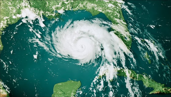
HazardHub Hurricane Risk Map of the U.S. Gulf Coast, which faces significant risks due to its geographical proximity to hurricane-prone waters.
For insurers, these maps serve as invaluable tools in accurately assessing risk, determining coverage options, and implementing strategic underwriting practices. By understanding the specific risk landscape at a specific location, insurers can make more informed decisions, resulting in better management of hurricane-related losses.
The availability of HazardHub’s Hurricane Risk Scores provides insurers, communities, and property owners with a wealth of data to guide their hurricane preparedness, emergency management, and risk management strategies.
Insurers can access this information through Guidewire applications, including PolicyCenter and InsuranceNow, and via the HazardHub API. For homeowners and consumers interested in evaluating their property’s risk, HazardHub offers a free resource at freehomerisk.com.
Hurricane Risk Data: Enhancing Resilience in High-Risk Areas
In regions where hurricanes and storm surges are a common threat, access to accurate and detailed risk information is crucial. By using HazardHub’s data, insurers can tailor their offerings to reflect the real risk levels properties face, ensuring that coverage is both comprehensive and equitable. Meanwhile, property owners and communities can use this information to bolster their preparedness plans, implement mitigation measures, and ultimately enhance their resilience against future hurricane and storm surge events.
Understanding the nuances of hurricane risk is vital for navigating the challenges posed by extreme weather. With Guidewire's HazardHub, insurers, communities, and property owners are equipped with the knowledge and tools to take proactive steps in mitigating these risks, paving the way for a safer and more resilient future.